
The Space Race
Puzzle 55 · The Road to the Moon · Page 79 in print
The Tracking Network
Goldstone, Madrid and Canberra sat a third of the globe apart; one always saw the Moon.
Jump to a word
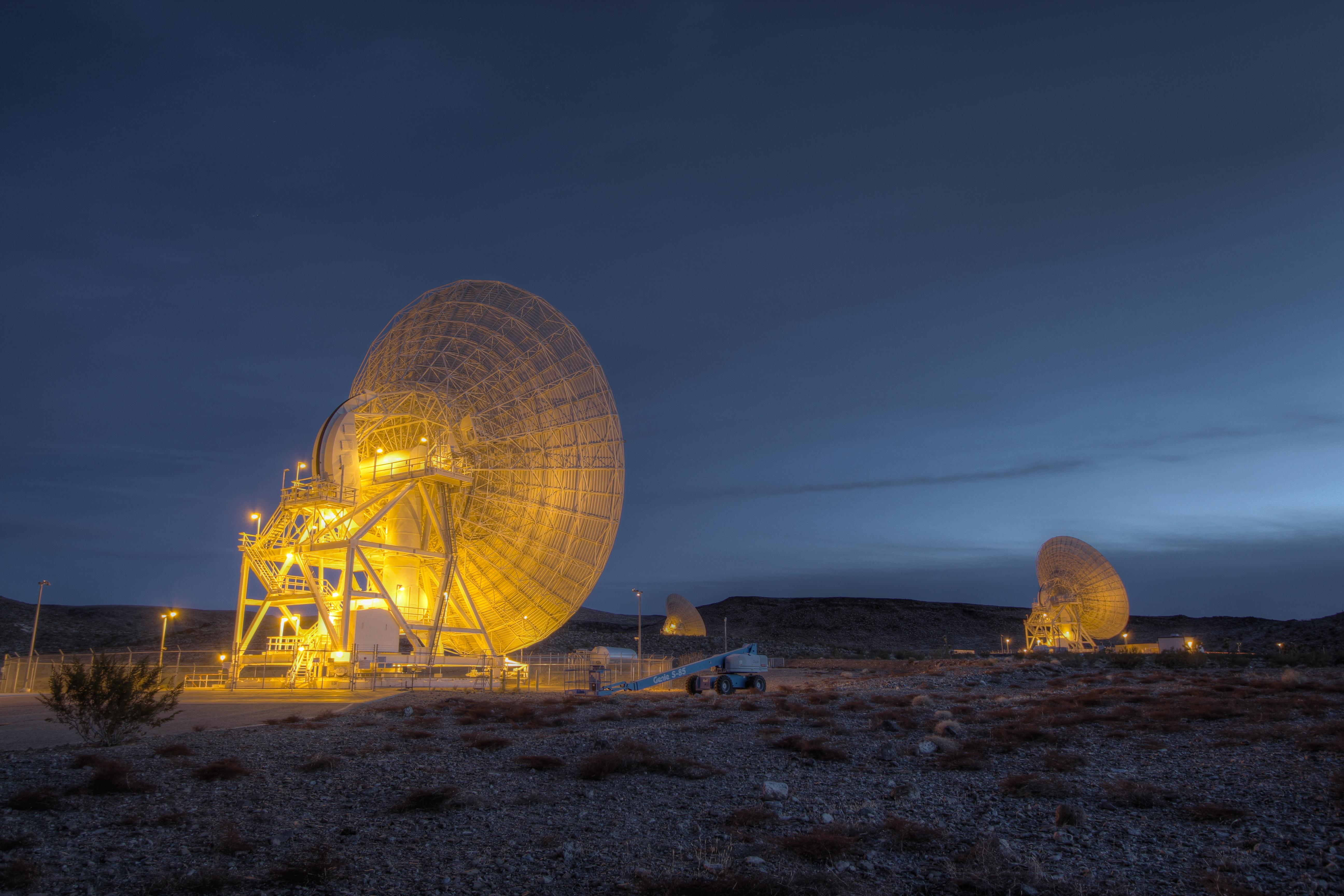
Goldstone’s beam-waveguide antennas in a later view published in 2013.
Courtesy NASA/JPL-Caltech (PIA17793) · JPL image-use policy · Original recordThe words
ARIA
Apollo Range Instrumentation Aircraft.
ARIA aircraft could relay astronaut voices and record spacecraft measurements over ocean areas without ground stations. NASA also assigned them to reentry support after radio blackout.
Did you know?
The aircraft’s large, rounded nose housed a dish antenna. Its unusual shape came from the communications equipment needed to follow the spacecraft.
NASA press kit, p. 179 · NASA: Apollo 11 network press kit (opens a new tab)
Ascension
The station on Ascension Island helped cover Apollo’s Atlantic launch path. It formed one link in a chain of ground stations, ships and aircraft.
NASA data book, vol. II, p. 554 · NASA: Apollo tracking network history (opens a new tab)
Bermuda
Bermuda was a prime station along Apollo’s launch path. Its equipment helped the network follow spacecraft during the early stages of a mission.
NASA data book, vol. II, p. 554 · NASA: Apollo tracking network history (opens a new tab)
Canary Islands
NASA’s network history lists Grand Canary among Apollo’s primary launch-path stations. The Canary Islands station helped extend the tracking chain across the Atlantic.
NASA data book, vol. II, p. 554 · NASA: Apollo tracking network history (opens a new tab)
Carnarvon
Carnarvon was an Australian station in Apollo’s tracking network. It and the Canberra station received backup support from the Deep Space Network installation at Tidbinbilla.
NASA data book, vol. II, p. 554 · NASA: Apollo tracking network history (opens a new tab)
Goldstone
Goldstone, California, helped receive Apollo 11’s lunar television in 1969. Honeysuckle Creek and Parkes in Australia also took part in receiving pictures from the Moon’s surface.
Guaymas
Guaymas, Mexico, was one of Apollo’s primary tracking stations. NASA’s network history placed it near the end of the worldwide chain, before Corpus Christi.
NASA data book, vol. II, p. 554 · NASA: Apollo tracking network history (opens a new tab)
Handover
As Earth turned, one station handed communications to another coming into view. This preserved coverage from Earth, but radio contact still stopped when the spacecraft passed behind the Moon.
NASA press kit, pp. 171, 173 · NASA: Apollo 11 network press kit (opens a new tab)
Honeysuckle
Honeysuckle Creek’s antenna supported Apollo’s lunar flights from Australia. It helped receive the first television pictures from the Moon’s surface in 1969, alongside Goldstone and Parkes.
Did you know?
After Honeysuckle Creek closed in 1981, its antenna moved to the Canberra Deep Space Communications Complex. There it received a new number, Deep Space Station 46.
Intelsat
Intelsat satellites linked distant receiving stations with network hubs on Earth. Apollo’s planned routes used these satellites to carry information from remote sites onward toward Houston.
NASA press kit, p. 176 · NASA: Apollo 11 network press kit (opens a new tab)
Kauai
Kauai’s tracking station stood in Kōkee State Park. First built for Mercury, it was adapted for Gemini and Apollo, extending the network across the Pacific.
Did you know?
In 1965, Neil Armstrong served at Kauai as the Gemini 3 capsule communicator. From there, he helped the crew prepare for reentry.
Madrid
The Madrid area held separate antennas for different NASA networks. Fresnedillas served the Manned Space Flight Network, while Robledo de Chavela and Cebreros supported the Deep Space Network.
Tidbinbilla
Tidbinbilla near Canberra supplied Apollo backup tracking. Its deep-space antenna gained extra Manned Space Flight Network equipment so it could help support crewed lunar missions.
Tracking Ship
Apollo tracking ships carried antennas into ocean areas beyond land-station range. These floating stations supplied tracking, spacecraft measurements and communications during key parts of a flight.
NASA press kit, p. 178 · NASA: Apollo 11 network press kit (opens a new tab)
Unified S-Band
S-band is a range of radio frequencies.
Apollo’s unified S-band system combined radio functions that otherwise needed separate carriers. A shared carrier reduced the space, weight and power needed aboard the spacecraft.
NASA data book, vol. II, p. 553 · NASA: Apollo tracking network history (opens a new tab)
Sources
- Honeysuckle Creek, AustraliaNASA; December 19, 2013; Apollo antenna, 1969 lunar pictures and transfer after 1981 closure
- Hawaii’s Role in NASA’s Space Exploration ProgramsJohn Uri; NASA Johnson Space Center; May 21, 2018; Kauai tracking station and Armstrong’s Gemini 3 CAPCOM role
- The Spanish StationsNASA; December 19, 2013; separate Madrid-area sites for the Manned Space Flight Network and Deep Space Network
- NASA Historical Data Book, Volume II: Programs and Projects 1958–1968Linda Neuman Ezell; NASA SP-4012, vol. II; 1988; pp. 553–554 (PDF pp. 554–555), Apollo network development and unified S-band
- Tidbinbilla, AustraliaNASA; December 19, 2013; DSS-42’s additional MSFN equipment for Apollo backup
- Apollo 11 Lunar Landing Mission Press KitNASA, Release 69-83K; released July 6, 1969, as printed on the cover; pp. 171, 173, 176 and 178–179 (PDF pp. 175, 177, 180 and 182–183), Manned Space Flight Network plans