
America’s National Parks
Puzzle 36 · The Rocky Mountains · Page 56 in print
Glacier
From the summit of Triple Divide Peak, water flows to the Atlantic Ocean, the Pacific Ocean and Hudson Bay.
Jump to a word
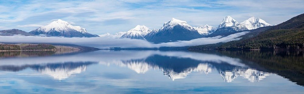
Clouds and light change the appearance of Lake McDonald.
NPS/Jacob W. Frank · Public domain (U.S. federal government work) · Original recordImage changes
Resized and converted to JPEG for display; no subject alteration.
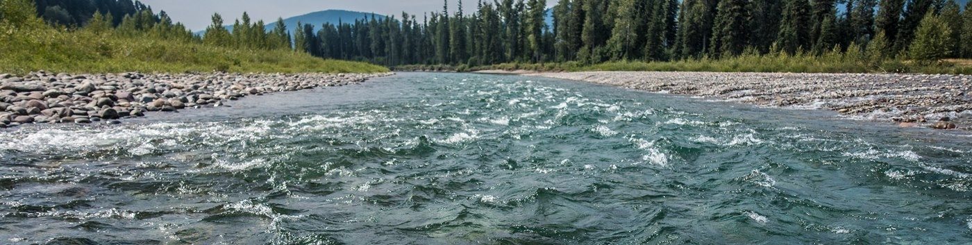
The North Fork of the Flathead River.
NPS · Public domain (U.S. federal government work) · Original recordImage changes
Resized and converted to JPEG for display; no subject alteration.
The words
Beargrass
Beargrass has wiry leaves and a tall stalk topped with dense white flowers. Despite its name and grass-like foliage, this Glacier wildflower belongs to a different plant family.
Did you know?
A beargrass plant can have several leaf rosettes sharing one root system. Each rosette flowers only once, rather than following a fixed seven-year cycle.
Blackfeet
The Blackfeet homeland includes the plains east of Glacier. The Park Service describes the 1895 transfer of the mountains east of the Continental Divide to the United States as occurring under pressure from miners.
Park Service: Glacier’s Indigenous history (opens a new tab) · Park Service: Mining and land transfer (opens a new tab)
Garden Wall
The Garden Wall is an arête, a thin, jagged ridge left between neighboring glaciers. Its steep sides and sharp crest preserve the shape of an earlier ice-filled landscape.
Going to the Sun
Going-to-the-Sun Road follows a route approved in 1924 after Frank Kittredge’s survey. Instead of repeated switchbacks below Logan Pass, it climbs in a long traverse along the Garden Wall.
Grinnell
Repeat photographs of Grinnell Glacier include paired views from 2016 and 2025. The wider research project returns to earlier camera positions, making photographs from different years easier to compare.
Park Service: Comparing glacier photographs (opens a new tab)
Lake McDonald
Lake McDonald occupies a broad, U-shaped valley carved by glaciers. Smaller hanging valleys above it record the same erosive force, with waterfalls linking higher basins to the main valley.
Park Service: Lake McDonald’s glacial basin (opens a new tab)
Logan Pass
Logan Pass carries Going-to-the-Sun Road across the Continental Divide. Subalpine meadows surround this high crossing, where wildflowers grow below the rocky mountain skyline.
Many Glacier
Many Glacier lies where four major valleys converge. Their meeting brings mountain scenery and ice-shaped terrain together in one part of the park, rather than naming a single glacier.
Mountain Goat
Glacier’s native mountain goats grip rocky terrain with split hooves that spread apart and flexible inner pads. These features help them climb the steep slopes of their alpine habitat.
Did you know?
Glacier’s citizen-science project trains volunteers to identify and count mountain goats from the ground, giving biologists another way to study populations in rugged terrain.
Peace Park
In 1932, Canada and the United States designated Waterton Lakes and Glacier as an international peace park. The partnership links conservation across a border that shared wildlife and watersheds cross.
Did you know?
Waterton-Glacier International Peace Park received UNESCO World Heritage designation in 1995, adding recognition of its natural value to the earlier international peace designation.
Red Jammers
Glacier began using its red tour buses in the 1930s. Drivers became known as Jammers because of the sound made when shifting gears on the park’s steep roads.
Saint Mary
Along Saint Mary Lake, limestone cliffs forced road builders to blast space for Going-to-the-Sun Road. They reused stone in the road’s masonry, including a large retaining wall built in 1933.
Swiftcurrent
Swiftcurrent Lake’s shore held a sawmill that processed nearby timber for Many Glacier Hotel. The Great Northern Railway completed the hotel for its July 4, 1915 opening.
Triple Divide
Triple Divide separates river systems as well as distant seas. Westward streams join the Flathead, Clark Fork and Columbia, linking Glacier’s mountain snow and rain with a much larger watershed.
Two Medicine
Two Medicine Valley holds a high-elevation lake surrounded by peaks. Its railway-era buildings also tell a tourism story: a chalet complex was built here in 1914.
Did you know?
President Franklin D. Roosevelt gave a public radio address from Two Medicine Chalet in 1934, bringing a presidential broadcast to this mountain setting.
Park Service: Glacier’s valleys (opens a new tab) · Park Service: Railway hotels and chalets (opens a new tab)
Sources
- History & Culture - Glacier National ParkNational Park Service
- Going-to-the-Sun Road Audio Tour - Glacier National ParkNational Park Service
- International Designations - Glacier National ParkNational Park Service
- Continental Divide - Glacier National ParkNational Park Service
- Beargrass Blooms in Glacier National ParkNational Park Service
- Early Settlers - Glacier National ParkNational Park Service
- Nunataks, Arêtes, and HornsNational Park Service
- Glacier Repeat PhotosNational Park Service
- Lake McDonald ValleyNational Park Service
- Places To Go - Glacier National ParkNational Park Service
- Mountain Goat Resource BriefNational Park Service
- Former Artists-in-Residence - Glacier National ParkNational Park Service
- Historic Lodges and ChaletsNational Park Service