
America’s National Parks
Puzzle 30 · The Great Plains · Page 48 in print
Scotts Bluff
Some Native Americans called Scotts Bluff “Me-a-pa-te,” or “hill that is hard to go around.”
Jump to a word
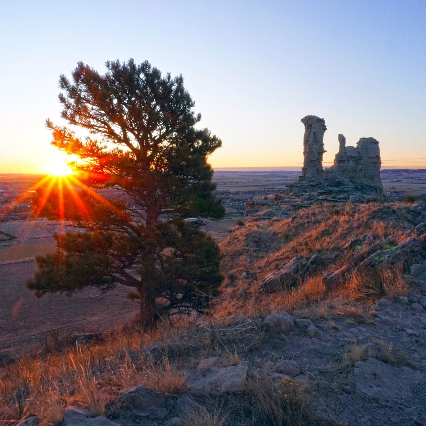
Saddle Rock at sunrise.
NPS/Eric Grunwald · Public domain (U.S. federal government work) · Original recordImage changes
Resized and converted to JPEG for display; no subject alteration.
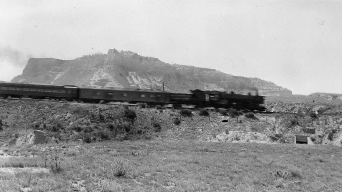
The railroad passes the boundary of Scotts Bluff National Monument.
NPS · Public domain (U.S. federal government work) · Original recordImage changes
Resized and converted to JPEG for display; no subject alteration.
The words
Buffalo Chips
Dried bison dung.
Where firewood was scarce on the plains, emigrants collected buffalo chips for cooking fires. This fuel linked the daily work of preparing meals to the bison herds along the trail.
Park Service: Life on the emigrant trails (opens a new tab) · Park Service: Travel along the Platte (opens a new tab)
Covered Wagon
Covered wagons carried emigrants’ belongings, usually pulled by oxen or mules. The monument’s replicas interpret this transport, including Murphy wagons with straight boxes rather than the curved beds of Conestoga freight wagons.
Did you know?
The Murphy wagon displayed at the monument was built by Dewitts Buggy Works in 1979, a later reconstruction of trail transportation.
Eagle Rock
Eagle Rock forms the northern side of Mitchell Pass, facing Sentinel Rock across the gap. Its half-dome shape marked the narrow passage used by wagon trains and Pony Express riders.
Did you know?
In an 1853 description of the pass, traveler Mariett Foster Cummings called this formation Sugar Loaf Rock.
Emigrants
Emigrants traveling toward Oregon, California and Utah faced deadly cholera and accidents. The Park Service describes how their wagons and livestock depleted grass and displaced game used by Indigenous communities.
Park Service: Choosing a route west (opens a new tab) · Park Service: Travel along the Platte (opens a new tab)
Handcart
Some Mormon converts used handcarts when they could not afford wagons. People pushed or pulled their possessions west, with limited carrying capacity restricting what they could bring.
Did you know?
The monument’s replica handcart was researched by Arnold Bateman and built by LeRoy Bateman.
Hiram Scott
Scott appears in an American Fur Company pay list as a clerk in 1827. He died near the bluff in 1828, but the Park Service cautions that the circumstances remain uncertain.
Park Service: Hiram Scott’s uncertain story (opens a new tab)
Mitchell Pass
After improvements around 1850, Mitchell Pass offered wagons a route back to the North Platte sooner than Robidoux Pass. Its narrow track forced wagon trains into dusty single-file traffic.
Park Service: Routes through Scotts Bluff (opens a new tab) · Park Service: Choosing a route west (opens a new tab)
Mormon Trail
Mormon emigrants heading to Utah generally followed the North Platte’s north bank. Those who began on its south side often stayed there on the Oregon Trail, so their routes around Scotts Bluff varied.
North Platte
The North Platte’s broad valley provided a natural corridor for westbound wagons. Near Scotts Bluff, badlands extending from the bluff to the river forced travelers to seek passes away from its banks.
Oregon Trail
The Oregon route linked Missouri River departure towns with western river valleys and mountain crossings. Scotts Bluff stood along a journey that typically took four to six months by wagon.
Pony Express
Pony Express riders carried mail through the Scotts Bluff corridor in 1860–1861. Nearby stations included Ficklin Spring; telegraph construction through Mitchell Pass helped end the short-lived service.
Robidoux Pass
Before Mitchell Pass was improved, wagons detoured through Robidoux Pass. A spring, trading post and blacksmith offered supplies and repairs, helping compensate for the longer route away from the river.
Saddle Rock
Saddle Rock takes its name from the hollow between two thin spires along the bluff’s edge. Its namesake trail crosses part of this narrow rock buttress on the way to the summit.
Scotts Bluff
Scotts Bluff survives because hard limestone caprock slows erosion of the layers below. Wind, streams and volcanic ash supplied sediments that record an ancient landscape very different from the emigrant corridor.
Did you know?
Some layers preserve invertebrate burrows, possibly dug by beetles or other insects, recording animal activity within the sediments.
Wagon Swales
Broad swales mark the old wagon route through Scotts Bluff. The softer sandstone and siltstone have eroded, widening the traces and obscuring the paired wheel ruts that once marked the ground.
Sources
- Traveling the Emigrant TrailsNational Park Service
- Hiram ScottNational Park Service
- Geology and Paleontology - Scotts Bluff National MonumentNational Park Service
- Mormon Handcart ReplicaNational Park Service
- The Road Through Scotts BluffNational Park Service
- Wagon SwalesNational Park Service
- The Five Rocks of Scotts Bluff - Scotts Bluff National MonumentNational Park Service
- Wagons on the Emigrant TrailsNational Park Service
- “Choices” WaysideNational Park Service
- The Platte ExperienceNational Park Service