
America’s National Parks
Puzzle 15 · Southeast and Caribbean · Page 29 in print
Gulf Islands
In 1886 Geronimo and 15 other Apache men were imprisoned at Fort Pickens, where they cleared weeds, planted grass and stacked cannonballs; their families joined them in 1887.
Jump to a word
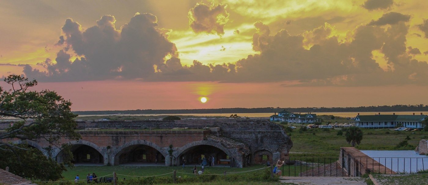
Sunset over Fort Pickens.
NPS Photo · Public domain (U.S. federal government work) · Original recordImage changes
Resized and converted to JPEG for display; no subject alteration.
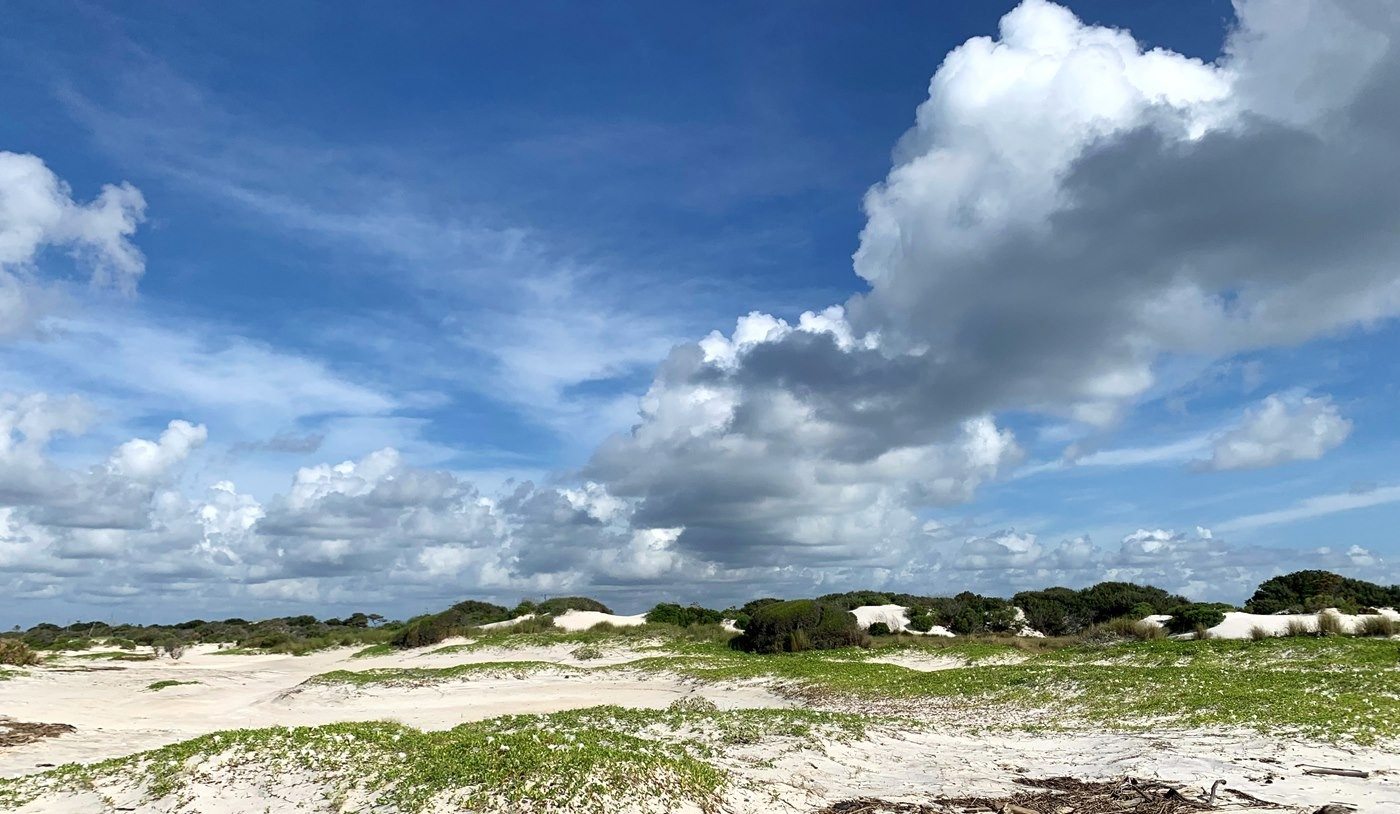
Wilderness islands within Gulf Islands National Seashore.
NPS/Wingate · Public domain (U.S. federal government work) · Original recordImage changes
Resized and converted to JPEG for display; no subject alteration.
The words
Beach Mouse
Perdido Key beach mice shelter in burrows among dunes and coastal scrub. At night they emerge to feed on seeds, fruit and insects, with sea oats providing an important food source.
Did you know?
Seeds stored by beach mice sometimes remain uneaten and sprout, helping establish plants whose roots stabilize the dunes.
Brown Pelican
Brown pelicans gather along the seashore’s coast and dive for fish. They fold their wings before entering the water, using their large bills to capture prey beneath the surface.
Did you know?
Air sacs beneath a brown pelican’s skin help cushion its impact when it plunges into the water for fish.
Davis Bayou
Davis Bayou represents the mainland salt-marsh side of Gulf Islands in Mississippi. Its winding waterways connect with Stark and Halstead bayous, supporting plant and animal life above and below the water.
Park Service: Davis Bayou marshes (opens a new tab) · Park Service: Gulf Coast ecosystems (opens a new tab)
Fort Barrancas
Completed in 1844, Fort Barrancas guarded Pensacola Bay from a bluff. Enslaved laborers shaped its defensive earthen slope, hauling sand and planting grass to protect the surface from erosion.
Park Service: Fort Barrancas history (opens a new tab) · Park Service: Enslaved fort laborers (opens a new tab)
Fort Pickens
Fort Pickens guarded the entrance to Pensacola Bay from western Santa Rosa Island. Enslaved men built the fort under Army engineer William Chase, completing the massive brick defenses in 1834.
Geronimo
The Army exiled Geronimo, an Apache medicine man and warrior, to Florida in 1886 and separated him from his family. He never returned to his homeland and died at Fort Sill in 1909.
Horn Island
Horn Island’s live oaks, pines and shrubs shelter birds, reptiles and other wildlife. Designated wilderness with Petit Bois in 1978, it preserves a barrier-island landscape off Mississippi’s coast.
Did you know?
Artist Walter Anderson repeatedly rowed to Horn Island, making paintings and sketches inspired by its wildlife, light and changing colors.
Park Service: Horn Island habitats (opens a new tab) · Park Service: Walter Anderson’s island art (opens a new tab)
Opal Beach
Opal Beach lies on Santa Rosa Island between Pensacola Beach and Navarre Beach. Its visitor area spans the island’s Gulf-facing and sound-facing sides, showing two different coastal settings.
Park Service: Santa Rosa and Opal Beach (opens a new tab) · Park Service: Opal Beach’s setting (opens a new tab)
Perdido Key
Perdido Key straddles the Florida–Alabama boundary. Its dunes and coastal scrub shelter beach mice, with the seashore’s Johnson Beach area forming part of their habitat alongside neighboring state parks.
Petit Bois
Petit Bois Island combines ponds, lagoons and marshes with a small slash-pine forest. Seagrass beds in its shallow waters shelter young fish, adding underwater habitat to the island’s protected wilderness.
Quartz Sand
The seashore’s sand contains quartz, a hard mineral eroded from the southern Appalachian Mountains. Rivers carried those grains toward the coast, where currents moved them westward along the shoreline.
Did you know?
The beaches look white even though their quartz grains are clear; coastal currents wash away much of the finer material.
Redoubt
An enclosed defensive fortification built to protect a position.
Advanced Redoubt protected the landward approaches to Fort Barrancas and the Pensacola Navy Yard. Enslaved workers began construction in 1845; free workers completed the fort in 1870.
Santa Rosa
Santa Rosa Island forms a natural barrier between open water and Pensacola Bay. Its beach and dune habitats support nesting shorebirds and sea turtles, with sea oats and other coastal grasses growing in the sand.
Park Service: Fort Pickens construction (opens a new tab) · Park Service: Gulf Coast ecosystems (opens a new tab)
Ship Island
Ship Island’s anchorage gave it military importance along Mississippi’s coast. Fort Massachusetts was built to protect shipping and a supply depot; paid workers and prisoners of war helped complete it in 1866.
Snowy Plover
Snowy plovers blend into the seashore’s pale beaches. They nest in shallow ground depressions lined with shell fragments and other material, and forage by running, pausing and picking small prey from the sand.
Did you know?
Snowy plover chicks leave the nest within three hours of hatching, flattening against the ground when a parent signals danger.
Sources
- Perdido Key Beach Mouse - Gulf Islands National SeashoreNational Park Service
- Brown Pelican - Gulf Islands National SeashoreNational Park Service
- Walter Anderson - Gulf Islands National SeashoreNational Park Service
- Apache PrisonersNational Park Service
- Santa Rosa Area - Gulf Islands National SeashoreNational Park Service
- Divergent Plate Boundary—Passive Continental Margins - GeologyNational Park Service
- Snowy Plovers - Gulf Islands National SeashoreNational Park Service
- Advanced RedoubtNational Park Service
- Fort BarrancasNational Park Service
- Fort Barrancas Self-Guided Tour Stop 1National Park Service
- Fort PickensNational Park Service
- Horn Island WildernessNational Park Service
- Petit Bois Island WildernessNational Park Service
- Davis Bayou OverlookNational Park Service
- Fort MassachusettsNational Park Service
- Gulf Coast Network EcosystemsNational Park Service
- Opal Beach AreaNational Park Service