
America’s National Parks
Puzzle 13 · Southeast and Caribbean · Page 27 in print
Cape Hatteras
In 1999 the Cape Hatteras Lighthouse was moved 2,900 feet in 23 days, setting it 1,500 feet back from the ocean.
Jump to a word
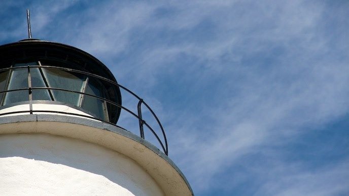
A close view of Ocracoke Lighthouse.
National Park Service · Public domain (U.S. federal government work) · Original recordImage changes
Resized and converted to JPEG for display; no subject alteration.
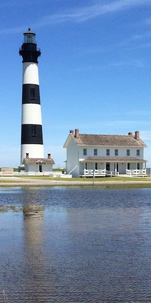
Bodie Island Lighthouse and its keepers' quarters.
National Park Service · Public domain (U.S. federal government work) · Original recordImage changes
Resized and converted to JPEG for display; no subject alteration.
The words
Banker Ponies
Horses have been documented on Ocracoke since the 1730s, working alongside island residents. The free-roaming animals were enclosed in 1959 to limit overgrazing and protect them from highway traffic.
Did you know?
In the late 1950s, Ocracoke Boy Scouts cared for the horses and rode as a mounted troop.
Blackbeard
Blackbeard spent much of his final five months at Ocracoke after accepting a royal pardon. He was killed there on November 22, 1718, fighting Royal Navy forces led by Lieutenant Robert Maynard.
Bodie Island
The third Bodie Island Lighthouse first shone on October 1, 1872. Unlike its two predecessors on Pea Island, the new tower stood north of Oregon Inlet.
Did you know?
Crews, equipment and materials from the recent Cape Hatteras lighthouse project helped build Bodie Island’s docks, dwellings and other facilities.
Buxton
Buxton’s lighthouse stands near maritime forest rather than an entirely treeless shore. The Buxton Woods trails pass through coastal woodland, with dunes and shrub thickets along the route toward Frisco.
Cape Point
Cape Point’s beach belongs to a coastline continually reshaped by storms, waves and wind. Sand moves along the shore and across the barrier islands, changing the land rather than remaining fixed.
Chicamacomico
Chicamacomico’s lifesaving station was established at Rodanthe in 1874. In 1918, Keeper John Allen Midgett and his crew rescued 42 sailors from the burning British tanker Mirlo.
Diamond Shoals
Diamond Shoals is a shifting series of shallow underwater sandbars off Cape Hatteras. Coastal shipping routes passed near these hazards, where storms, heavy seas and strong currents made navigation difficult.
Graveyard
The regional name Graveyard of the Atlantic recalls ships and people lost off the Outer Banks. Sandbars, storms and converging currents contributed to wrecks; wartime attacks added to the losses.
Lighthouse
Cape Hatteras’s brick lighthouse first shone on December 16, 1870. Its spiral stripes were added in 1873 as a distinctive daytime mark, helping mariners tell it apart from other coastal lights.
Did you know?
Before electrification, the keeper wound clockwork each day to turn the lighthouse’s optic, while a kerosene lamp supplied the light.
Ocracoke
Ocracoke grew as a home for ship pilots guiding vessels through its inlet. Its white lighthouse was completed in 1823, but correspondence dates the first lighting to August 15, 1824.
Did you know?
The Lighthouse Service sent traveling libraries to its isolated employees, circulating cases of books among coastal light stations every six months.
Oregon Inlet
A hurricane opened Oregon Inlet in 1846. Winds, tides and moving sand continually reshape its entrance and channels, making the inlet a changing passage between the sound and the Atlantic.
Outer Banks
The Outer Banks are barrier islands between mainland North Carolina and the Atlantic. Cape Hatteras National Seashore includes land on Bodie, Hatteras and Ocracoke islands, with marshes, dunes and ocean beaches.
Piping Plover
Piping plovers nest on sandy beaches above the high-tide line and on flats between dunes. Their small bodies and pale feathers blend into the sand, helping conceal them from predators.
Rodanthe
Erosion at Rodanthe left houses exposed to direct wave action. On September 29, 2023, the Park Service purchased two threatened properties with help from the National Park Trust’s appraisal work.
Surfmen
Surfmen staffed coastal lifesaving stations, watching from towers and patrolling the beach for vessels in distress. Regular rescue drills and equipment maintenance prepared crews to launch surfboats or use shore-based rescue apparatus.
Sources
- Bodie Island Light Station - Cape Hatteras National SeashoreNational Park Service
- Cape Hatteras Light Station - Cape Hatteras National SeashoreNational Park Service
- Ocracoke Light Station - Cape Hatteras National SeashoreNational Park Service
- Common and Protected Birds - Cape Hatteras National SeashoreNational Park Service
- Ocracoke HorsesNational Park Service
- Chicamacomico Life Saving StationNational Park Service
- Oregon Inlet NavigationNational Park Service
- Hiking - Cape Hatteras National SeashoreNational Park Service
- Blackbeard (Edward Teach)National Park Service
- Lost to the Perils of the SeaNational Park Service
- Monitoring at Cape Hatteras National SeashoreNational Park Service
- Cape Hatteras National Seashore, NCNational Park Trust
- NPS Geodiversity Atlas—Cape Hatteras National Seashore, North CarolinaNational Park Service
- The U.S. Life-Saving ServiceNational Park Service