
America’s National Parks
Puzzle 42 · The Colorado Plateau · Page 64 in print
Bryce Canyon
Bryce Canyon is not a canyon but a series of more than a dozen amphitheaters, each carved at least a thousand feet into the limestone of the Paunsaugunt Plateau.
Jump to a word
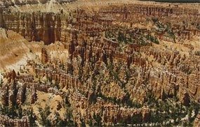
Bryce Canyon's intricate rock landscape.
NPS · Public domain (U.S. federal government work) · Original recordImage changes
Resized and converted to JPEG for display; no subject alteration.
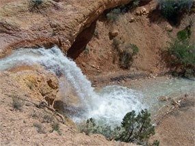
Tropic Ditch falls near the Mossy Cave Trail.
NPS · Public domain (U.S. federal government work) · Original recordImage changes
Resized and converted to JPEG for display; no subject alteration.
The words
Claron
The Claron Formation, the sedimentary rock formation sculpted into Bryce's hoodoos.
Ebenezer Bryce
Ebenezer Bryce, the settler whose logging road gave the canyon its English name.
Fairyland
Fairyland Point, the overlook connected with the Fairyland Loop trail.
Frost Wedging
Frost wedging, the freezing and expansion of water that cracks Bryce's rock.
Hoodoos
Hoodoos, the irregularly eroded rock spires at Bryce Canyon.
Paiute
The Paiute people, an Indigenous people with historical connections to the Bryce region.
Paunsaugunt
The Paunsaugunt Plateau, the plateau whose eastern edge contains Bryce's amphitheaters.
Pink Cliffs
The Pink Cliffs, the colorful upper cliffs of the Grand Staircase at Bryce.
Queens Garden
Queens Garden, the named trail area below Sunrise Point.
Rainbow Point
Rainbow Point, a named overlook at the southern end of the park road.
Silent City
Silent City, the dense rows of hoodoos beside Sunset Point.
Sunrise Point
Sunrise Point, a named overlook at Bryce Canyon.
Sunset Point
Sunset Point, the overlook above Thor's Hammer and the Silent City.
Thor's Hammer
Thor's Hammer, the named hoodoo below Sunset Point.
Sources
- Park Brochure - Bryce Canyon National ParkNational Park Service
- A Pioneer Story - Bryce Canyon National ParkNational Park Service
- History & Culture - Bryce Canyon National ParkNational Park Service
- Sunset PointNational Park Service
- Bryce PointNational Park Service